Detroit
Contents
- 1 Quote
- 2 Appearance
- 3 Introduction
- 4 City Device
- 5 Motto
- 6 Climate
- 7 Districts
- 8 Downtown Detroit
- 9 Demonym
Quote
“Detroit is largely composed, today, of seemingly endless square miles of low-density failure.” -― Jane Jacobs, The Death and Life of Great American Cities
Appearance
Introduction
Detroit is the most populous city in the U.S. state of Michigan and the largest city on the United States–Canada border. It is the seat of Wayne County, the most populous county in the state. It is a primary business, cultural, financial and transportation center in the Metro Detroit area, a region of 5.3 million people. It is a major port on the Detroit River, a strait that connects the Great Lakes system to the Saint Lawrence Seaway. It was founded on July 24, 1701, by the French explorer and adventurer Antoine Laumet de La Mothe, sieur de Cadillac and a party of settlers.
The Detroit area emerged as a significant metropolitan region within the United States in the early 20th century, and this trend only hastened in the 1950s and 1960s, with the construction of a regional freeway system. Detroit is the center of a three-county Urban Area (population 3,734,090, area of 1,337 square miles (3,460 km2), a 2010 United States Census) six-county Metropolitan Statistical Area (2010 Census population of 4,296,250, area of 3,913 square miles [10,130 km2]), and a nine-county Combined Statistical Area (2010 Census population of 5,218,852, area of 5,814 square miles [15,060 km2]). The Detroit–Windsor area, a commercial link straddling the Canada–U.S. border, has a total population of about 5,700,000. The Detroit metropolitan region holds roughly one-half of Michigan's population.
Known as the world's automotive center, "Detroit" is a metonym for the American automobile industry. Detroit's auto industry was an important element of the American "Arsenal of Democracy" supporting the Allied powers during World War II. It is an important source of popular music legacies celebrated by the city's two familiar nicknames, the Motor City and Motown. Other nicknames arose in the 20th century, including City of Champions, beginning in the 1930s for its successes in individual and team sport; The D; Hockeytown (a trademark owned by the city's NHL club, the Red Wings); Rock City (after the Kiss song "Detroit Rock City"); and The 313 (its telephone area code).
Between 2000 and 2010 the city's population fell by 25 percent, changing its ranking from the nation's 10th-largest city to 18th. In 2010, the city had a population of 713,777, more than a 60 percent drop from a peak population of over 1.8 million at the 1950 census. This resulted from suburbanization, industrial restructuring and the decline of Detroit's economic strength. Following the shift of population and jobs to its suburbs or other states or nations, the city focused on reestablishing itself as the metropolitan region's employment and economic center. Downtown Detroit has held an increased role as an entertainment destination in the 21st century, with the restoration of several historic theaters, several new sports stadiums, three new stadiums, and a riverfront revitalization project. More recently, the population of Downtown Detroit, Midtown Detroit, and a handful of other neighborhoods has increased. Many other neighborhoods remain distressed and even heavily abandoned.
The Governor of Michigan, Rick Snyder, declared a financial emergency for the city in March 2013, appointing an emergency manager. On July 18, 2013, Detroit filed the largest municipal bankruptcy case in U.S. history. It was declared bankrupt by Judge Steven W. Rhodes of the Bankruptcy Court for the Eastern District of Michigan on December 3, 2013; he cited its $18.5 billion debt and declared that negotiations with its thousands of creditors were unfeasible. On November 7, 2014, Judge Rhodes approved the city's bankruptcy plan, allowing the city to begin the process of exiting bankruptcy. The City of Detroit successfully left Chapter 9 municipal bankruptcy with all finances handed back to Detroit beginning at midnight on December 11, 2014.
"Once the hub of the United States' automotive manufacturing, Detroit, Michigan has become a shell of its former industrial self. Detroit is valuable territory for the Sabbat despite its economic woes, and the sect seeks to revitalize the city with a shift in industrial focus. With one of the highest murder rates in the United States, Detroit (which has been known as "the murder capital of the U.S.") provides ample feeding grounds for its dwellers. Unlike some of their brethren to the south, the Sabbat of Detroit do not concentrate on capturing neighboring Camarilla cities. Rather, the city's vampires focus on bolstering the flagging fortunes of their home. After all, the Sabbat must have the proper resources if it is to launch a successful attack..." -- Ja'ala Eli, Keeper of Chronicles
City Device
Motto
Speramus Meliora; Resurget Cineribus -- (Latin: We Hope For Better Things; It Shall Rise From the Ashes)
Climate
Detroit and the rest of southeastern Michigan have a humid continental climate which is influenced by the Great Lakes. Winters are cold, with moderate snowfall and temperatures not rising above freezing on an average 44 days annually, while dropping to or below 0 °F (−18 °C) on an average 4.4 days a year; summers are warm to hot with temperatures exceeding 90 °F (32 °C) on 12 days.[98] The warm season runs from May to September. The monthly daily mean temperature ranges from 25.6 °F (−3.6 °C) in January to 73.6 °F (23.1 °C) in July. Official temperature extremes range from 105 °F (41 °C) on July 24, 1934 down to −21 °F (−29 °C) on January 21, 1984; the record low maximum is −4 °F (−20 °C) on January 19, 1994, while, conversely the record high minimum is 80 °F (27 °C) on August 1, 2006, the most recent of five occurrences. A decade or two may pass between readings of 100 °F (38 °C) or higher, which last occurred July 17, 2012. The average window for freezing temperatures is October 20 thru April 22, allowing a growing season of 180 days.
Precipitation is moderate and somewhat evenly distributed throughout the year, although the warmer months such as May and June average more, averaging 33.5 inches (850 mm) annually, but historically ranging from 20.49 in (520 mm) in 1963 to 47.70 in (1,212 mm) in 2011. Snowfall, which typically falls in measurable amounts between November 15 through April 4 (occasionally in October and very rarely in May), averages 42.5 inches (108 cm) per season, although historically ranging from 11.5 in (29 cm) in 1881−82 to 94.9 in (241 cm) in 2013−14. A thick snowpack is not often seen, with an average of only 27.5 days with 3 in (7.6 cm) or more of snow cover. Thunderstorms are frequent in the Detroit area. These usually occur during spring and summer.
Districts
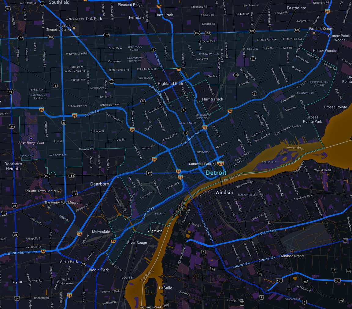
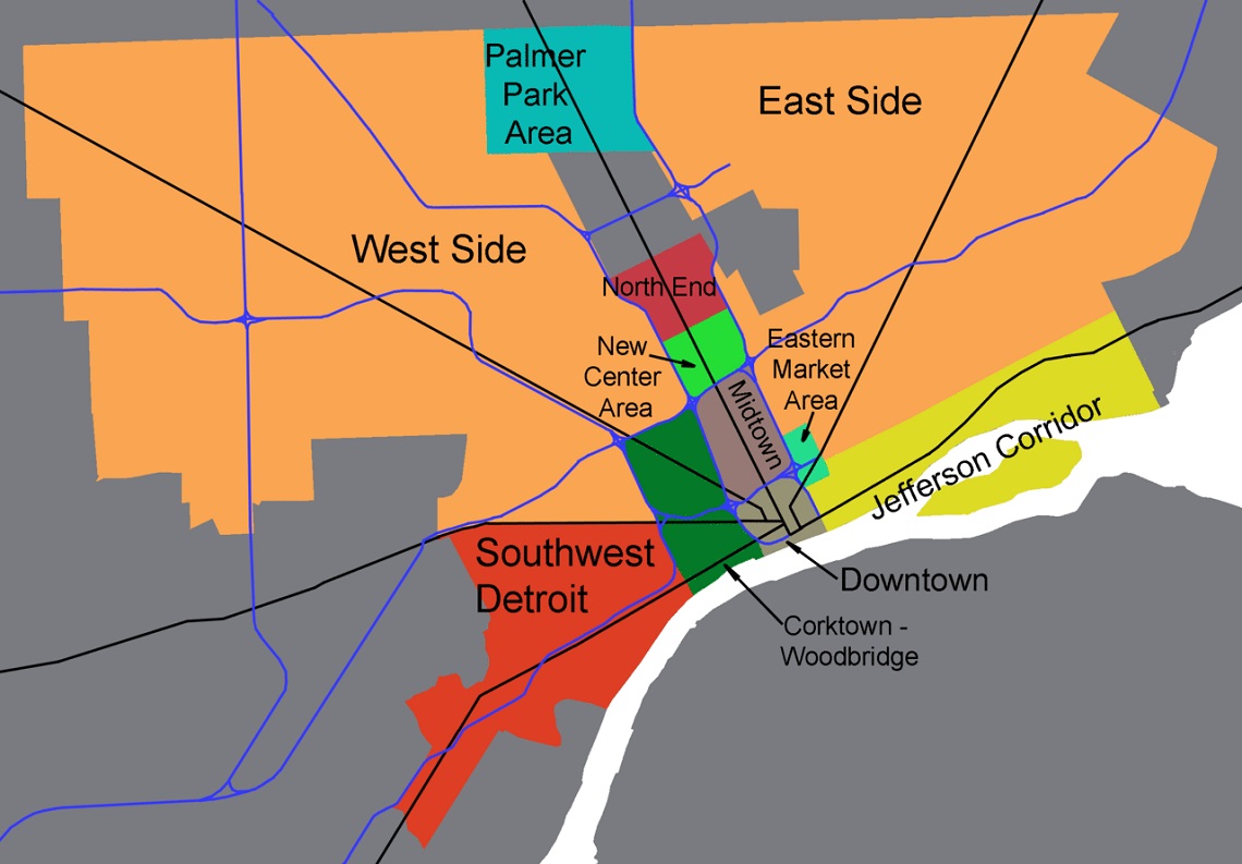
https://en.wikipedia.org/wiki/List_of_neighborhoods_in_Detroit
Downtown Detroit
Midtown
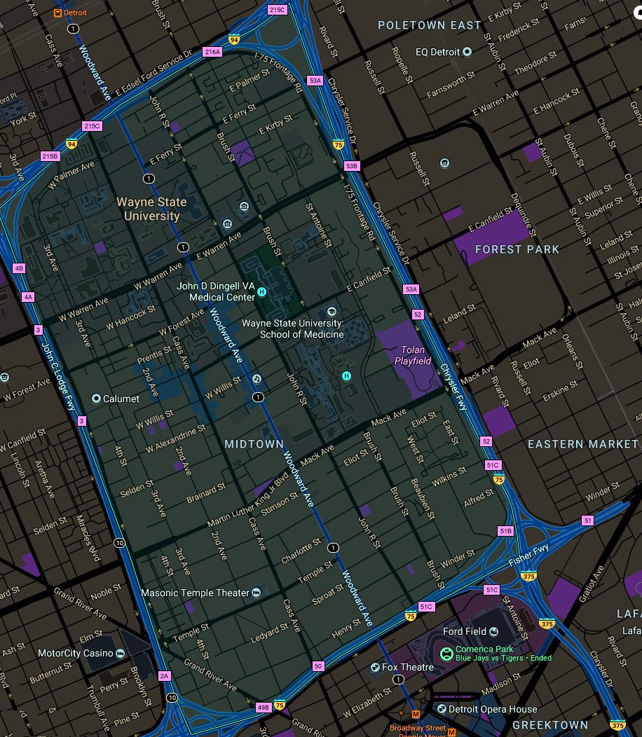
Midtown Detroit is an area covering roughly two square miles between Downtown Detroit to the south and New Center to the north along Woodward Avenue. Its boundaries are the Ford, Chrysler, Fisher, and Lodge Freeways. It includes the Art Center and the Medical Center in the northeast quadrant, Wayne State University's campus, the Detroit Public Library, and the Detroit Historical Museum in the northwest, and the Cultural Center including various restaurants, galleries, newly constructed lofts/condos and nightlife venues along Woodward in the center, among other things.
Art Center two Miles (3 km) north of downtown, is centered on the Cultural Center Historic District, which is listed in the National Register of Historic Places. The Cultural Center is roughly bounded by Cass Avenue to the west, I-75 to the east, I-94 to the north and Warren Avenue to the south. It also includes the East Ferry Avenue Historic District. Attractions include the Detroit Institute of Arts, the Charles H. Wright Museum of African American History, the Scarab Club, the Detroit Historical Museum, the Museum of Contemporary Art Detroit, the main library of the Detroit Public Library system and the Detroit Science Center. The College for Creative Studies is located adjacent the Scarab Club and opposite the East face of the Detroit Institute of Arts. The main campus of Wayne State University is located adjacent to the area, on the opposite side of Woodward.
Sub-districts
Places of Interest
- Detroit Masonic Temple -- Former Tremere Chantry of Detroit, now used exclusively by the Tremere Antitribu of the Sabbat. {Cass Park Historic District}
Sources
https://en.wikipedia.org/wiki/Midtown_Detroit
New Center Area
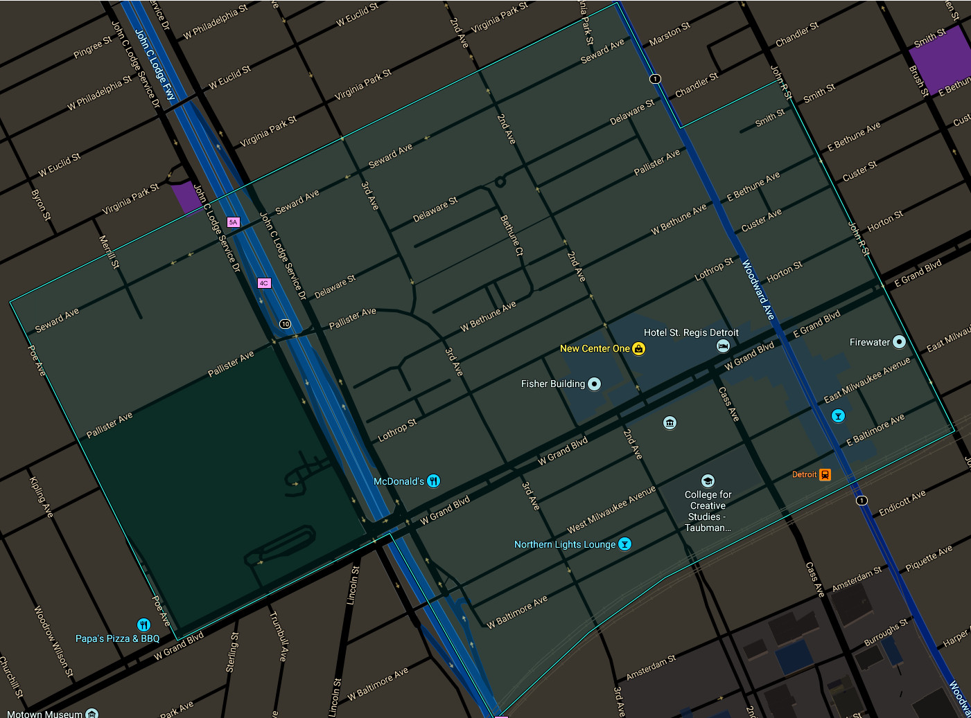
New Center is a commercial and residential historic district located uptown in Detroit, Michigan, adjacent to Midtown, one mile (1.6 km) north of the Cultural Center, and approximately three miles (5 km) north of Downtown. The area is centered just west of the intersection of Woodward Avenue and Grand Boulevard, and is approximately bounded by the Virginia Park Historic District on the north, the Edsel Ford Freeway (I-94) on the south, John R Street on the east and the Lodge Freeway on the west.
North End
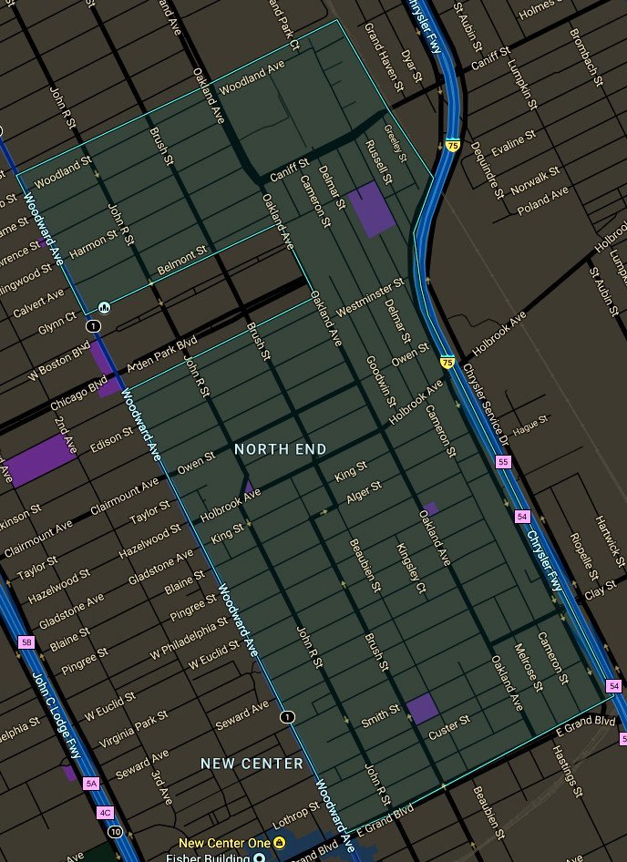
The northern area includes the Detroit Golf Club and neighborhoods which surround the main campus of the University of Detroit Mercy: Pilgrim Village; Palmer Park Apartment Building Historic District; and the Palmer Woods Historic District. Pilgrim Village, developed in the 1920s, is bounded by Livernois, Idaho, Puritan and Fenkell. It is the birthplace of the Honey Baked Ham Company, which started on Fenkell in 1957. Palmer Park Apartment Building Historic District along with the nearby Palmer Woods Historic District are located within the area. Adjacent to the neighborhood is a 140-acre (0.6 km²) park named Palmer Park. The neighborhood and the park were the property of Thomas Witherell Palmer. The neighborhood consists of stately apartment buildings as well as some single-family detached homes.
Palmer Woods is known for its elm-lined streets, large brick homes, and Tudor style architecture. Palmer Woods is located on the west side of Detroit. It is bordered by 7 Mile Road, M-102 (8 Mile Road), M-1 (Woodward Avenue), and the Sherwood Forest neighborhood. Lots are large, with ample room for trees, play equipment, and a good expanse of grass. It is the home of physicians, academics, business owners, artists, executives and their families.
East Side
[[]]
Upper
Central
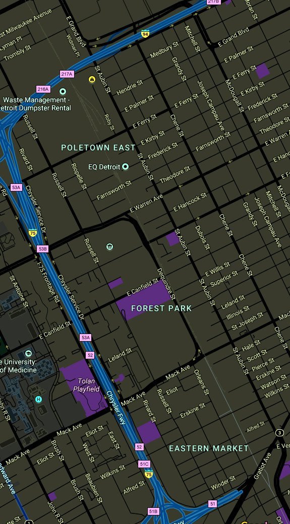
Central Detroit comprises three distinct areas that abut one another from south-east to north-west and include: Eastern Market, Forest Park and Poletown East.
Eastern Market
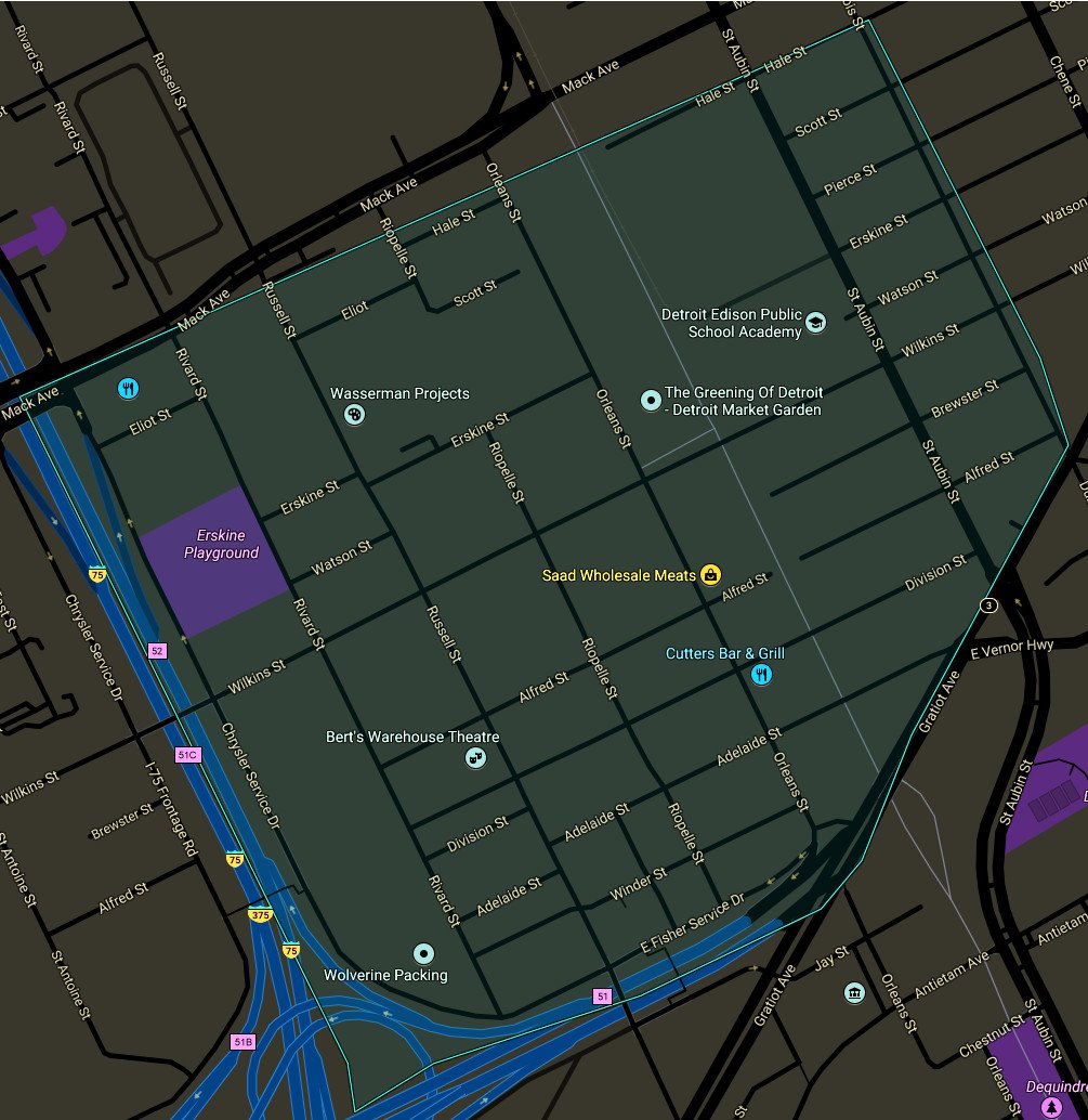
Eastern Market is a historic commercial district in Detroit, Michigan. It is located approximately one mile (1.6 km) northeast of the city's downtown and is bordered on the south by Gratiot Avenue, the north by Mack Avenue, the east by St. Aubin Street, and the west by Interstate 75 (I-75, Chrysler Freeway). The district was designated a Michigan State Historic Site in 1974 and listed on the National Register of Historic Places in 1978; the district's boundary was increased in 2007. The Eastern Market is located on the city's central east side near St. Joseph Roman Catholic Church and the Lafayette Park neighborhood. The market was transferred from city management in 2006, and now operates through a public-private partnership with the Eastern Market Corporation. Eastern Market is the largest historic public market district in the United States, and the Eastern Market farmer's distribution center is the largest open-air flowerbed market in the United States and has more than 150 foods and specialty businesses. On Saturdays, about 45,000 people shop the city's historic Eastern Market.
Forest Park
[[]]
Forest Park houses the St Albertus Roman Catholic Church and the Detroit Branch of the Federal Reserve Bank. It is a highly desirable neighborhood valued for the fact that demolition of blighted properties, beginning in 2008, started here first. As such, many tracts of land remain sparsely populated with a low density of residents.
Poletown East
[[]]
Poletown East is a neighborhood area of Detroit, Michigan bordering the enclave city of Hamtramck. The area was named after the Polish immigrants who originally lived in the area. A portion of residential area known as Poletown became the General Motors Detroit/Hamtramck Assembly plant in 1981 with those residents relocated by General Motors and the cities of Detroit and Hamtramck which claimed eminent domain in order to make way for a new automobile plant.
Lower
- Packard Automotive Plant -- A ruined automotive plant.
- The Packard Motel -- Last refuge of the fallen.
Corktown - Woodbridge
[[]]
Jefferson Corridor
[[]]
Eastern Market Area
[[]]
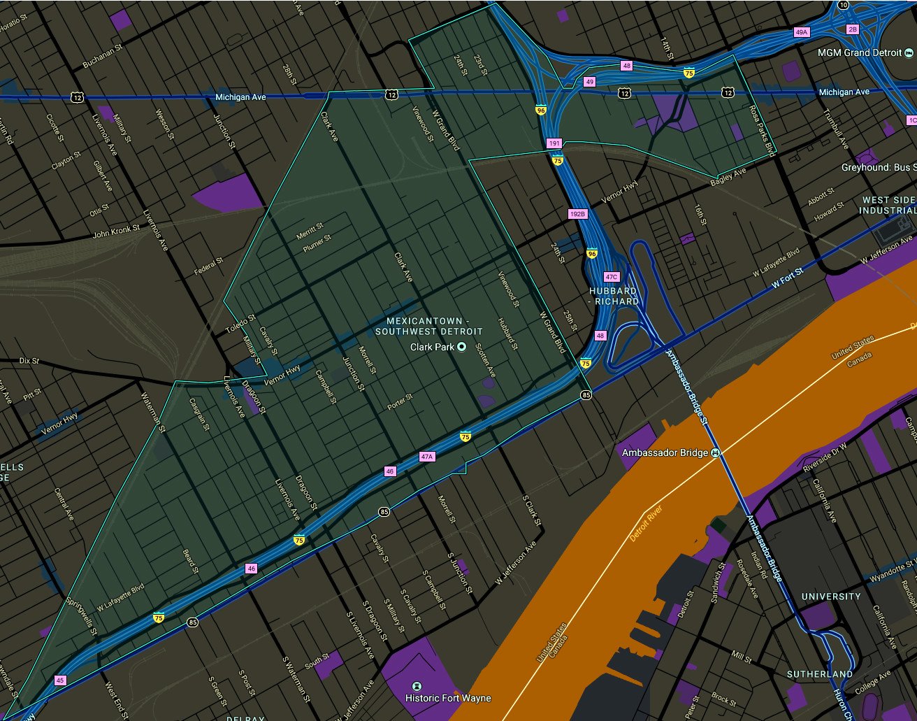
Southwest Detroit
Palmer Park Area
[[]]
East Side
[[]]
West Side
[[]]
Independent Cities of the Detroit Metro
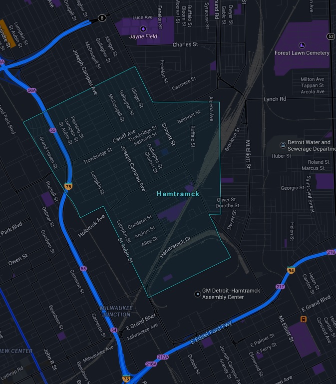
Hamtramck -- Michigan's most ethnically diverse city.
http://en.wikipedia.org/wiki/Hamtramck,_Michigan
Highland Park
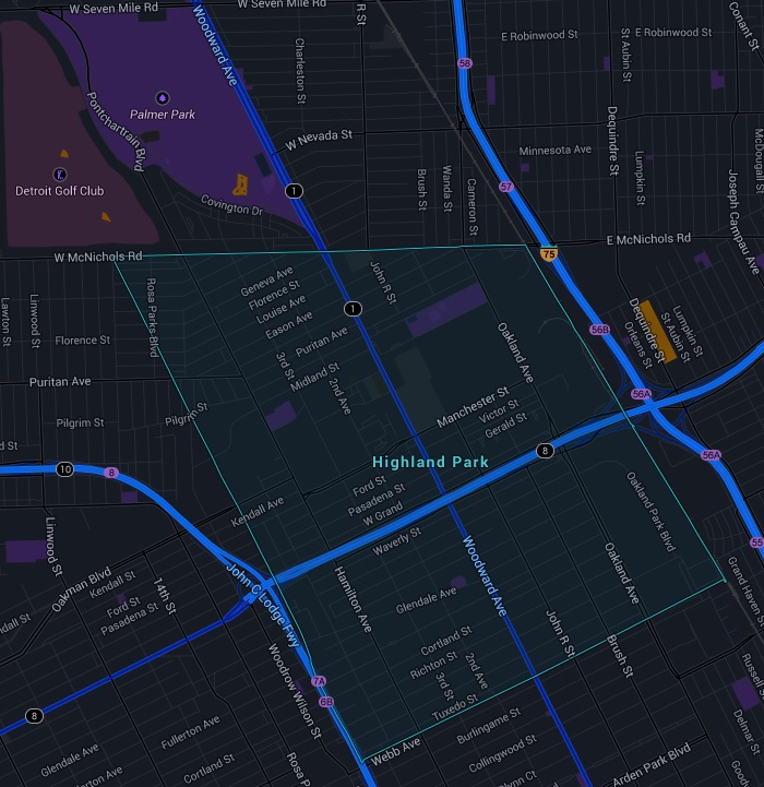
http://en.wikipedia.org/wiki/Highland_Park,_Michigan
Demonym
Detroiter

