Albert Park
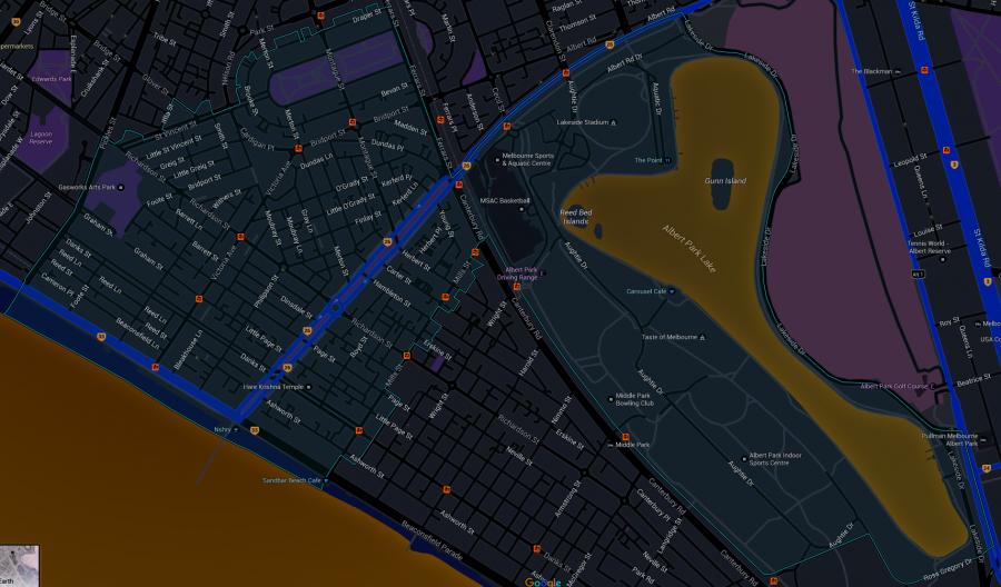
Albert Park is a suburb of Melbourne, Australia, 3 km south of Melbourne's central business district. Its local government area is the City of Port Phillip. At the 2011 census, Albert Park had a population of 5,955.
The suburb of Albert Park extends from the St Vincent Gardens to Beaconsfield Parade and Mills Street. It was settled residentially as an extension of Emerald Hill (South Melbourne). It is characterised by wide streets, heritage buildings, terraced houses, open air cafes, parks and significant stands of mature exotic trees, including Canary Island Date Palm and London Planes. It is an extremely beautiful suburb.
Since 1996 Albert Park has been home to the Australian Grand Prix, a motor racing event.
History
Indigenous Australians first inhabited the area that is now Albert Park around 40,000 years ago.[citation needed] The area was a series of swamps and lagoons.
The main park after which the suburb was named was declared a public park and named in 1864 to honour Queen Victoria's consort, Prince Albert.
Albert Park was used as a garbage dump, a military camp and for recreation before the artificial lake was built.
In 1854 a land-subdivision survey was done from Park Street, South Melbourne, to the northern edge of the parkland (Albert Road). St Vincent Gardens were laid out and the surrounding streets became the best address for successful citizens. Street names commemorated Trafalgar and Crimean War personalities.
Heritage Victoria notes that Albert Park's St Vincent Gardens "is historically important as the premier 'square' development in Victoria based on similar models in London. It is significant as the largest development of its type in Victoria and for its unusual development as gardens rather than the more usual small park" and "was first laid out in 1854 or 55, probably by Andrew Clarke, the Surveyor-General of Victoria. The current layout is the work of Clement Hodgkinson, the noted surveyor, engineer and topographer, who adapted the design in 1857 to allow for its intersection by the St Kilda railway line. The precinct, which in its original configuration extended from Park Street in the north to Bridport Street in the south and from Howe Crescent in the east to Nelson Road and Cardigan Street in the west, was designed to emulate similar 'square' developments in London, although on a grander scale. The main streets were named after British naval heroes. The development of the special character of St Vincent Place has been characterised, since the first land sales in the 1860s, by a variety of housing stock, which has included quality row and detached houses and by the gardens which, although they have been continuously developed, remain faithful to the initial landscape concept."
St Vincent's is a garden of significant mature tree specimens. It is registered with the National Trust and is locally significant for the social focus the gardens provide to the neighbourhood. Activities in the park range from relaxing walks, siestas to organised sports competition. The Albert Park Lawn Bowls Club was established in 1873 and the Tennis Club established 1883, on the site of an earlier croquet ground.
