Difference between revisions of "The Reeve's Territory"
(Created page with ";Thorton Bryant -z- Kingston upon Hull File:The Black Reeves Domain Kingston upon Hull map.jpg <br> <br> '''Description:''' The Reeve's (or the prince of Hull's) d...") |
(No difference)
|
Latest revision as of 23:41, 15 December 2014

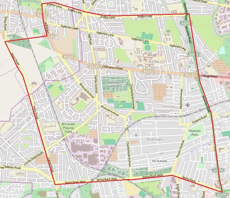
Description: The Reeve's (or the prince of Hull's) domain is defined as rough square bound on all four cardinal sides by major traffic arteries. The northern boundary road is Endyke Lane from its intersection with Hull Road to its intersection with Beverley Road (A1079). It is bound in the west by Hull Road from its intersection with Endyke Lane south to where it turns into Calvert Road and intersects with Spring Bank West. In the east the domain is defined by Beverley Road (A1079) from its intersection in the north with Endyke Lane and south to its intersection with Spring Bank Road East. The domain's southern border is Spring Bank Road from where it intersects with Calvert Road in the west to its intersection with Beverley Road (A1079) at its south-eastern corner. The domain is roughly 2 miles square and consists of a number of small but valuable neighborhoods and local institutions including the Avenues, the Dukeries, the University of Hull, St.Mary's College, the Humberside Police HQ, the Police Sports Club, the Hull Daily Mail Publications, Pearson Park, the Western Old and New Cemetery, and a number of lesser sites of interest. It is bound by the Hull neighborhoods of Sculcoates in the east, Orchard Park to the north, Anlaby Common in the west, Gypsyville and Old Town to the south.