Houston: Difference between revisions
| Line 36: | Line 36: | ||
The outlying areas of Houston, as well as the rest of Bellaire, the Memorial Villages, the airports and the city's suburbs and enclaves are outside the loop. Another ring road, Houston Beltway (also known simply as the ''"Beltway"''), encircles the city another 5 miles (8 km) further out. A third, ring-road or highway christened the ''"Grand Parkway,"'' has begun construction roughly 10 miles (16 km) beyond the ''Beltway'' around the outer suburbs and currently extends from north of the New Republic Highway 10 east of Katy to old Highway 59 in Sugar Land. | The outlying areas of Houston, as well as the rest of Bellaire, the Memorial Villages, the airports and the city's suburbs and enclaves are outside the loop. Another ring road, Houston Beltway (also known simply as the ''"Beltway"''), encircles the city another 5 miles (8 km) further out. A third, ring-road or highway christened the ''"Grand Parkway,"'' has begun construction roughly 10 miles (16 km) beyond the ''Beltway'' around the outer suburbs and currently extends from north of the New Republic Highway 10 east of Katy to old Highway 59 in Sugar Land. | ||
<br> | <br> | ||
* -- <<Downtown Houston>> | * -- <<Downtown Houston>> | ||
Revision as of 20:22, 5 February 2014
Quote
Houston, Tranquillity Base here. The Eagle has landed. -- Neil Armstrong -- 20:17:58 -- July 20, 1969 C.E.
Introduction
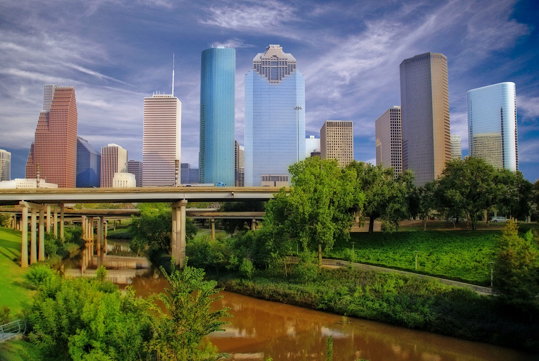
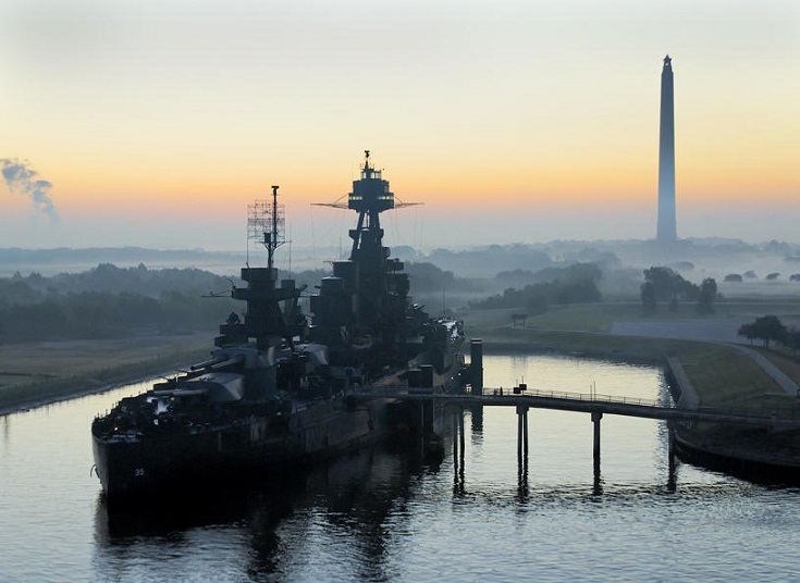
The city of Houston is both the capital and largest city in the new Republic of Texas. Houston was founded in 1836 on land near the banks of Buffalo Bayou (now known as Allen's Landing) and incorporated as a city on June 5, 1837. The city was named after former General Sam Houston, who was president of the original Republic of Texas and had commanded and won at the Battle of San Jacinto 25 miles (40 km) east of where the city was established. The burgeoning port and railroad industry, combined with oil discovery in 1901, has induced continual surges in the city's population. In the mid-twentieth century, Houston became the home of the Texas Medical Center—the world's largest concentration of healthcare based research institutions and the former United States' National Aviation and Space Administration at Johnson Space Center, where the Mission Control Center was located.
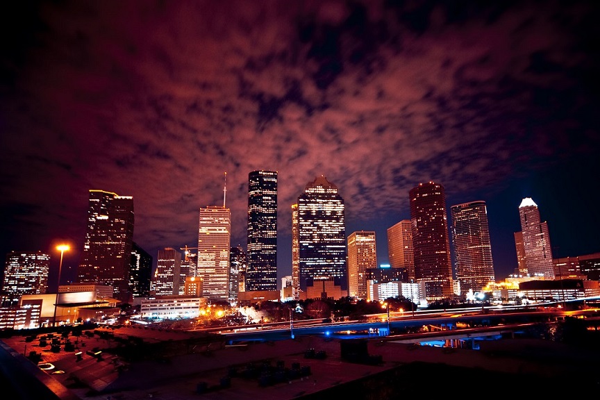
Houston's economy has a broad industrial base in aeronautics, energy production, manufacturing, and transportation. It is also North America's leading city in terms of health care research and oilfield equipment production. Today, Houston is headquarters to more Fortune 500 companies than the Federated American States financial capital of New York City. The Port of Houston ranks first among North American ports in terms of international waterborne and total cargo tonnage handled. The city has an expanding population formed from a variety ethnic-religious backgrounds and a extensive flourishing international community. It is home to many cultural institutions and exhibits, which attract more than 20 million visitors a year to the Museum District. Houston has an active visual and performing arts scene in the Theater District and offers year-round resident companies in all major performing arts.
Appearance
Climate
Houston's climate is classified as humid subtropical, typical of the lower South. While not necessarily part of "Tornado Alley" like much of the rest of Texas, spring supercell thunderstorms do sometimes bring tornadoes to the area. Prevailing winds are from the south and southeast during most of the year, bringing heat from the western deserts and moisture from the Gulf of Mexico.
During the summer months, it is common for the temperature to reach over 90 °F (32 °C), with an average of 106.5 days per year above 90 °F (32 °C) and at least 4.6 days at or over 100 °F (38 °C). However, the humidity causes a heat index higher than the actual temperature. Summer mornings average over 90 percent relative humidity and approximately 60 percent in the afternoon. Winds are often light in the summer and offer little relief, except near the immediate coast. To cope with the heat, people use air conditioning in nearly every vehicle and building in the city; in 1980 Houston was described as the "most air-conditioned place on earth". Scattered afternoon showers and thunderstorms are common in the summer. The hottest temperature ever recorded in Houston is 109 °F (43 °C), which was reached both on September 4, 2000 and August 28, 2011.
Winters in Houston are mild. The average high in January, the coldest month, is 63 °F (17 °C), while the average low is 43 °F (6 °C). Snowfall is very rare. Recent snow events in Houston include a storm on December 24, 2004 when one inch (2.5 cm) fell and more recent snowfalls on December 10, 2008. This was the earliest snowfall ever recorded in Houston. Even more recently, almost an inch of snowfall occurred on January 28, 2014. In addition, it set another milestone marking the first time in recorded history that snowfall has occurred in two consecutive years, and was the third accumulating snowfall occurring in the decade of 2000–2010. The coldest temperature ever recorded in Houston was 5 °F (−15 °C) on January 23, 1940. Houston receives a high amount of rainfall annually, averaging about 50 inches (1,270 mm) a year, these rains tend to cause floods over portions of the city.
Houston has excessive ozone levels and is routinely ranked among the most ozone-polluted cities in the United States. Ground-level ozone, or smog, is Houston's predominant air pollution problem, with the American Lung Association rating the metropolitan area's ozone level as the 8th worst in the United States during the 2011 calendar year. The industries located along the ship channel are a major cause of the city's air pollution. In the past, Houston's air quality has been compared to that of Los Angeles.
Device
Districts
Houston was incorporated in 1837 under the ward system of representation. The ward designation is the progenitor of the eleven current-day geographically oriented Houston City Council districts. Locations in Houston are generally classified as either being inside or outside the New Republic's Intercity Loop. The inside encompasses the central business district and many residential neighborhoods that predate World War II. More recently, high-density residential areas have been developed within the loop. The city's outlying areas, suburbs and enclaves are located outside of the loop. Beltway 8 encircles the city another 5 miles (8.0 km) farther out.
Although Houston was the largest city in the former United States without formal zoning regulations, it has developed similarly to other Sun Belt cities because the city's land use regulations and legal covenants have played a similar role. Regulations include mandatory lot size for single-family houses and requirements that parking be available to tenants and customers. Such restrictions have had mixed results. Though some have blamed the city's low density, urban sprawl, and lack of pedestrian-friendliness on these policies, the city's land use has also been credited with having significant affordable housing, sparing Houston the worst effects of the 2008 real estate crisis.
During the twentieth century, voters rejected efforts to have separate residential and commercial land-use districts in 1948, 1962, and 1993. Consequently, rather than a single central business district as the center of the city's employment, multiple districts have grown throughout the city in addition to downtown which include Uptown, Texas Medical Center, Midtown, Greenway Plaza, Memorial City, Energy Corridor, Westchase, and Greenspoint.
The geographic districts of Houston are generally classified as either being inside or outside the Intercity Loop, known as the "Loop." Inside the loop generally encompasses the Central business district and the "island cities" of West University Place (West U.), Southside Place and a portion of Bellaire. ("Island cities" refers to the City of Houston's practice of annexing around the existing boundaries of incorporated municipalities.)
Other "island cities" include the Memorial Villages — Bunker Hill Village, Hedwig Village, Hilshire Village, Hunters Creek Village, Piney Point Village, and Spring Valley Village.
The outlying areas of Houston, as well as the rest of Bellaire, the Memorial Villages, the airports and the city's suburbs and enclaves are outside the loop. Another ring road, Houston Beltway (also known simply as the "Beltway"), encircles the city another 5 miles (8 km) further out. A third, ring-road or highway christened the "Grand Parkway," has begun construction roughly 10 miles (16 km) beyond the Beltway around the outer suburbs and currently extends from north of the New Republic Highway 10 east of Katy to old Highway 59 in Sugar Land.
- -- <<Downtown Houston>>
- -- <<South Side Houston>>
- -- <<Southwest Houston>>
- -- <<Southeast Houston>>
- -- <<Northside Houston>>
- -- <<Energy Corridor of Houston>>
- -- <<Midtown Houston>>
- -- <<Uptown Houston>>
- -- <<Texas Medical Center of Houston>>
- -- <<Museum District of Houston>>
- -- <<The Six Wards of Houston>>
- -- <<Greenway Plaza of Houston>>
- -- <<Neartown of Houston>>
- -- <<Houston Heights>>
- -- <<River Oaks of Houston>>
- -- <<Memorial Area of Houston>>
- -- <<Clear Lake City -- Houston>>
- -- <<Kingwood -- Houston>>
Old Island Cities
- -- <<Bellaire of Houston>>
- -- <<West University Place of Greater Houston>>
- -- <<Southside Place of Greater Houston>>
- -- <<Memorial Villages of Greater Houston>>
New Island Cities
- -- <<>>
- -- <<>>
- -- <<>>
- -- <<>>
- -- <<>>
- -- <<>>
- -- <<>>
- -- <<>>
- -- <<>>
Demonym
Houstonian
Economy
Geography
According to the Census Bureau of the New Republic of Texas, the city has a total area of 656.3 square miles (1,700 km2); this comprises 634.0 square miles (1,642 km2) of land and 22.3 square miles (58 km2) of water. Most of Houston is located on the gulf coastal plain, and its vegetation is classified as temperate grassland and forest. Much of the city was built on forested land, marshes, swamp, or prairie, which are all still visible in surrounding areas. Flatness of the local terrain, when combined with urban sprawl, has made flooding a recurring problem for the city. Downtown stands about 50 feet (15 m) above sea level, and the highest point in far northwest Houston is about 125 feet (38 m) in elevation. The city once relied on groundwater for its needs, but land subsidence forced the city to turn to ground-level water sources such as Lake Houston, Lake Conroe and Lake Livingston. The city owns surface water rights for 1.20 billion gallons of water a day in addition to 150 million gallons a day worth of groundwater.
Houston has four major bayous passing through the city. Buffalo Bayou runs through downtown and the Houston Ship Channel, and has three tributaries: White Oak Bayou, which runs through the Houston Heights community northwest of Downtown and then towards Downtown; Braes Bayou, which runs along the Texas Medical Center; and Sims Bayou, which runs through the south of Houston and downtown Houston. The ship channel continues past Galveston and then into the Gulf of Mexico.
Geology
Underpinning Houston's land surface are unconsolidated clays, clay shales, and poorly cemented sands up to several miles deep. The region's geology developed from river deposits formed from the erosion of the Rocky Mountains. These sediments consist of a series of sands and clays deposited on decaying organic marine matter, that over time, transformed into oil and natural gas. Beneath the layers of sediment is a water-deposited layer of halite, a rock salt. The porous layers were compressed over time and forced upward. As it pushed upward, the salt dragged surrounding sediments into salt dome formations, often trapping oil and gas that seeped from the surrounding porous sands. The thick, rich, sometimes black, surface soil is suitable for rice farming in suburban outskirts where the city continues to grow.
The Houston area has over 150 active faults (estimated to be 300 active faults) with an aggregate length of up to 310 miles (500 km), including the Long Point–Eureka Heights fault system which runs through the center of the city. There have been no significant historically recorded earthquakes in Houston, but researchers do not discount the possibility of such quakes having occurred in the deeper past, nor occurring in the future. Land in some areas southeast of Houston is sinking because water has been pumped out of the ground for many years. It may be associated with slip along the faults; however, the slippage is slow and not considered an earthquake, where stationary faults must slip suddenly enough to create seismic waves. These faults also tend to move at a smooth rate in what is termed "fault creep", which further reduces the risk of an earthquake.
History
Population
- -- City (3,046,758) - 2031 census
- -- Urban (6,971,508) - 2031 census
- -- Metro Area (8,771,390) - 2031 census
Arenas
- -- [[]]
Attractions
- -- Electric Daisy Carnival -- Texas
- -- Rendez-vous Houston
- -- Rodeo Houston
- -- Screamworld
- -- [[]]
- -- [[]]
Bars and Clubs
Cemeteries
- -- [[]]
City Government
- -- [[]]
Crime
- -- [[]]
Citizens of the City
- -- [[]]
Current Events
- -- [[]]
Fortifications
- -- [[]]
Galleries
- -- [[]]
Holy Ground
- -- [[]]
Hospitals
- -- [[]]
Hotels & Hostels
- -- [[]]
Landmarks
- -- [[]]
Maps
- -- [[]]
Mass Media
Mega-Corporations
- -- Endron
Military
Monuments
- -- [[]]
Museums
- -- [[]]
Parks
- -- [[]]
Private Residences
- -- [[]]
Restaurants
Ruins
- -- [[]]
Schools
- -- [[]]
Shopping
- -- [[]]
Sports
- -- <<Houston Astros>> (professional basketball team)
- -- <<Houston Dynamo>> (American Major League Soccer club)
- -- <<Houston Rockets>> (professional basketball team)
- -- Houston Texans (professional American football team)
Telecommunications
- -- [[]]
Theaters
- -- [[]]
Transportation
- -- [[]]
The Vampires of Houston
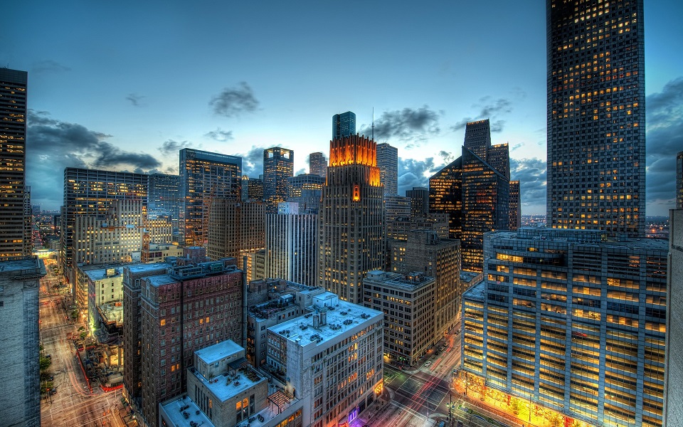
Houston's ever growing mortal population makes it not only the political capital of the Republic of Texas, it is also one of the few cities in North America where the resident population of undead can expand without the threat of either overpopulation or violent political coups. Currently, Houston serves as a haven to 87 Kindred of the Camarilla, a few individuals of the independent clans and what remains of the dispossessed Camarilla court of Dallas-Fort Worth. However, the two decades old Siege of Houston by the Mexican Sabbat has caused regular turnover at all levels of Kindred society save for its prince and Primogen. -- Galen, Primogen of Clan Ventrue
- -- Carl Wisor -- Prince of Houston
- -- Isabel Manara -- Seneschal of Houston and Eldest of Houston's Gangrel.
- -- Martiné -- Brujah Primogen of Houston.
- -- Ruth McGinley -- Malkavian Primogen.
- -- Don Carlos -- Nosferatu Primogen.
- -- Carson Longbaugh -- Primogen of the Toreador.
- -- Constantin Addams -- Tremere Regent and Primogen.
- -- Galen -- Ventrue Primogen.
- -- Crenshaw Ghast -- Former Primogen of Dallas.
- -- Stevie Reno -- Sheriff of Houston
- -- [[]] --
- -- [[]] --
- -- [[]] --
- -- [[]] --
- -- Enzo Giovanni -- Member of the Board of Directors of Enron Oil Inc.
- -- Edward D.Chalmers -- Personal assistant (all around dogsbody) to Mr.Giovanni.
- -- Evans Rogers -- Freelance Bodyguard -- Assamite -- Warrior Caste.
- -- [[]] --
- -- [[]] --
- -- [[]] --
- -- [[]] --
- -- [[]] --
- -- [[]] --
- -- [[]] --
- -- [[]] --
- -- [[]] --
- -- [[]] --
