Scottish Borders: Difference between revisions
Jump to navigation
Jump to search
No edit summary |
No edit summary |
||
| Line 8: | Line 8: | ||
====== ''Geography'' ====== | |||
====== ''History'' ====== | |||
====== ''Places of Interest'' ====== | |||
====== ''Politics'' ====== | |||
====== ''Population'' ====== | |||
====== ''Towns and Villages'' ====== | |||
====== ''Transportation'' ====== | |||
====== ''Websites'' ====== | ====== ''Websites'' ====== | ||
http://www.bestoftheborders.co.uk/index.htm | http://www.bestoftheborders.co.uk/index.htm | ||
Revision as of 22:15, 3 February 2014

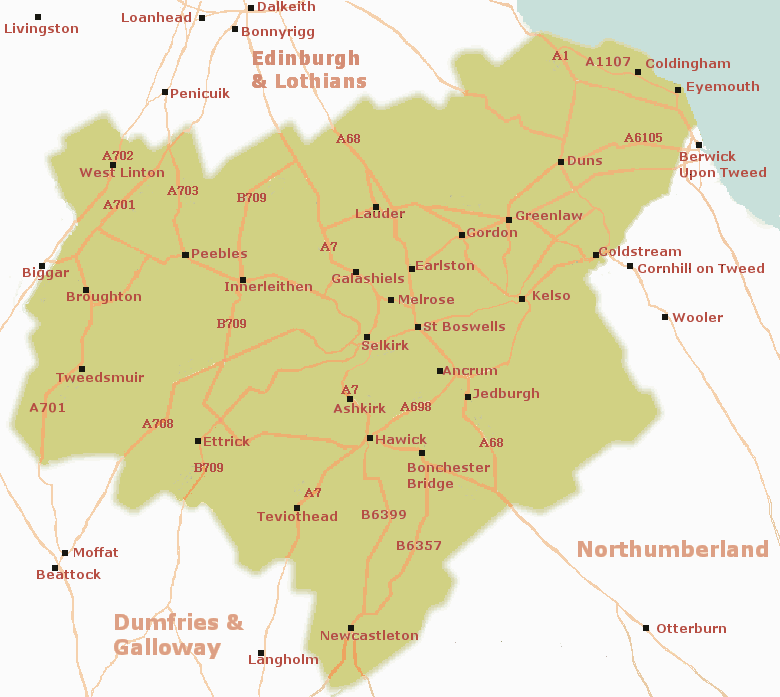
Description: The Scottish Borders, also known by its residents as "The Mairches." It is one of the thirty-two council areas of Scotland. It shares it's borders with the council areas known as Dumfries and Galloway, South Lanarkshire, West Lothian, the City of Edinburgh, Midlothian and East Lothian. It in turn, is bordered to the south and east by the non-metropolitan counties of Cumbria and Northumberland in England. The administrative center of the area is Newtown St. Boswells.
Etymology: Historically, the name Scottish Borders designated the entire border region of southern Scotland and, together with neighboring areas of England, was part of the historical Borders region.