Back Bay: Difference between revisions
| (One intermediate revision by the same user not shown) | |||
| Line 21: | Line 21: | ||
== Back Bay's Crowning Jewel: Copley Square == | == Back Bay's Crowning Jewel: Copley Square == | ||
[[]] | |||
<br> | |||
<br> | |||
Copley Square, named for painter John Singleton Copley, is a public square in Boston's Back Bay neighborhood, bounded by Boylston Street, Clarendon Street, St. James Avenue, and Dartmouth Street. | |||
== Websites == | |||
https://en.wikipedia.org/wiki/Copley_Square | |||
Latest revision as of 18:11, 24 April 2016
Introduction
Back Bay is an officially recognized neighborhood of Boston, Massachusetts. It is most famous for its rows of Victorian brownstone homes — considered one of the best preserved examples of 19th-century urban design in the United States — as well as numerous architecturally significant individual buildings, and cultural institutions such as the Boston Public Library. It is also a fashionable shopping destination (especially Newbury and Boylston Streets, and the adjacent Prudential Center and Copley Place malls) and home to some of Boston's tallest office buildings, the Hynes Convention Center, and numerous major hotels. Prior to a colossal 19th-century filling project, Back Bay was a literal bay. Today, along with neighboring Beacon Hill, it is one of Boston's two most expensive residential neighborhoods.
History
Before its transformation into build-able land by a 19th-century filling project, the Back Bay was literally a bay, west of the Shawmut Peninsula (on the far side from Boston Harbor) between Boston and Cambridge, the Charles River entering from the west. This bay was tidal: the water rose and fell several feet over the course of each day, and at low tide much of the bay's bed was exposed as a marshy flat. As early as 5,200 years before present, Native Americans built fish weirs here, evidence of which was discovered during subway construction in 1913 (see Ancient Fishweir Project and Boylston Street Fishweir).
In 1814, the Boston and Roxbury Mill Corporation was chartered to construct a milldam, which would also serve as a toll road connecting Boston to Watertown, bypassing Boston Neck. However, the project was an economic failure, and in 1857 a massive project was begun to "make land" by filling the area enclosed by the dam.
The firm of Goss and Munson built additional railroad trackage extending to quarries in Needham, Massachusetts, 9 miles (14 km) away. Twenty-five 35-car trains arrived every 24 hours carrying gravel and other fill, at a rate in the daytime of one every 45 minutes. (William Dean Howells recalled "the beginnings of Commonwealth Avenue, and the other streets of the Back Bay, laid out with their basements left hollowed in the made land, which the gravel trains were yet making out of the westward hills.") Present-day Back Bay itself was filled by 1882; the project reached existing land at what is now Kenmore Square in 1890, and finished in the Fens in 1900. Much of the old mill dam remains buried under present-day Beacon Street. The project was the largest of a number of land reclamation projects which, beginning in 1820, more than doubled the size of the original Shawmut Peninsula.
Completion of the Charles River Dam in 1910 converted the former Charles estuary into a freshwater basin; the Charles River Esplanade was constructed to capitalize on the river's newly enhanced recreational value. The Esplanade has since undergone several changes, including the construction of Storrow Drive.
Roads
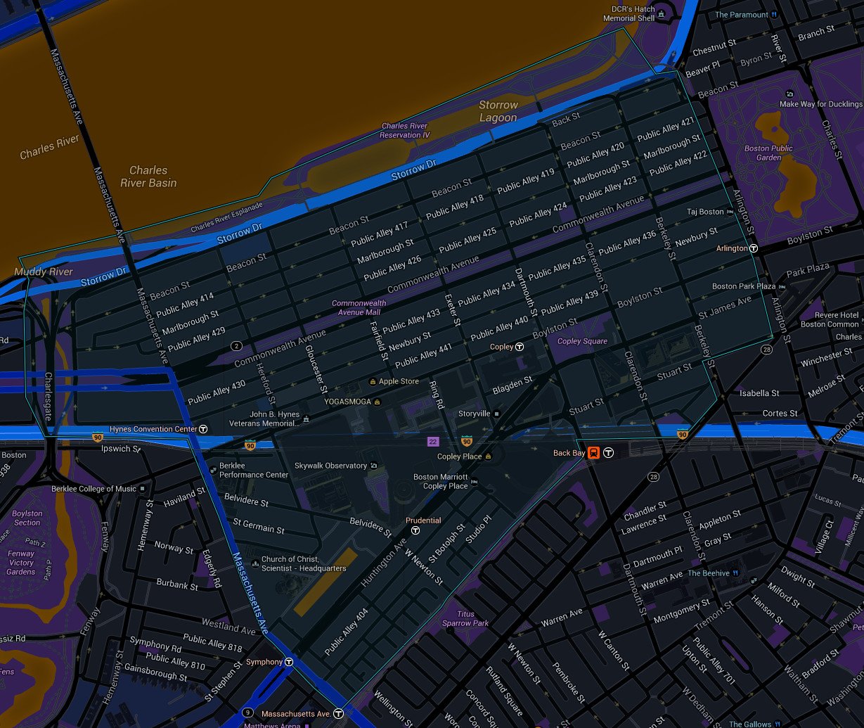
The Back Bay is traversed by five east-west corridors: Beacon Street, Marlborough Street, Commonwealth Avenue, Newbury Street and Boylston Street. These are interrupted at regular intervals by running from north to south streets: Arlington (along the western border of the Boston Public Garden), Berkeley, Clarendon, Dartmouth, Exeter, Fairfield, Gloucester and Hereford Streets. All of the west-east streets, except Commonwealth Avenue, are one-way streets.
In the 1960s, the "High Spine" design plan, in conjunction with development plans, gave way to the construction of high-rise buildings along the Massachusetts Turnpike, which in turn allowed the development of major projects in the area.
Back Bay's Crowning Jewel: Copley Square
[[]]
Copley Square, named for painter John Singleton Copley, is a public square in Boston's Back Bay neighborhood, bounded by Boylston Street, Clarendon Street, St. James Avenue, and Dartmouth Street.
